Our Solutions
Crantya’s strong experience and skills enables to provide answers in varies areas that are critical for development related decision. The use of GIS leads to dramatic improvements in efficiency as it facilitates faster decision-making based on accurate and timely information. More importantly, the quality of decision-making improves as decisions are driven by integrated and visual information.
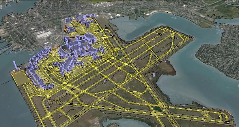
Airport Mapping Database
Airport Mapping Database (AMDB): Collection of aerodrome information that is organized and arranged for ease of electronic storage and retrieval in systems that support aerodrome surface . movements, charting, and planning..
Geo-data for Telecoms
There are ways to extract this data, we prefer and recommends to extracts from high resolution stereo satellite imagery. Since it is stereo imagery, extract detailed height information detained as raster grids with each pixel representing a height value
Mines and Minarals
Mineral extraction operations involve unique logistical challenges. CGPL provides mine owners and operators with geo-spatial services throughout the life cycle of a mine—during exploration and feasibility studies, ore extraction, mine closure, and landscape restoration.


