About Us
Our story began in 1993 by entering in Geo-spatial technology; those were the initial days for digital phase in soft-copy mapping. Back then we are mostly doing business in INDIA and now (2019) we established 2 more offices in USA and CANADA.
Today, we have many happy customers. We achieved this by offering very best service with quality and reliability.
Our Business

Services
The wide range of expertise in the group arises from the historical involvement of its members in government and private sectors. As a result, the portfolio of services that the firm provides is comprehensive
Software Development
Our expertise lies in implementing cost-effective solutions to complex business problems through uniquely blending business, technology, and process. Our proven analysis process, regardless of technology platform, will transform business ideas or challenges into successful solutions.
Solutions
Our key field is Geo-spatial technology, it is increasingly applied in organizations today for its information-rich and highly visual interface that enables real-time business decisions.
Infrastructure
Infrastructure field is our upcoming business……….
Our Services
We provide a wide range of professional Geo-spatial service to meet your needs. We promise to provide every product with high end quality level, less price and to your highest level of satisfaction.


Solutions
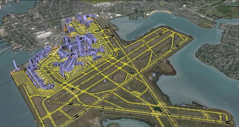
Airport Mapping Database
Airport Mapping Database (AMDB): Collection of aerodrome information that is organized and arranged for ease of electronic storage and retrieval in systems that support aerodrome surface . movements, charting, and planning..

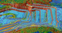
Geo-data for Telecoms
There are ways to extract this data, we prefer and recommends to extracts from high resolution stereo satellite imagery. Since it is stereo imagery, extract detailed height information detained as raster grids with each pixel representing a height value
Mines and Minarals
Mineral extraction operations involve unique logistical challenges. CGPL provides mine owners and operators with geo-spatial services throughout the life cycle of a mine—during exploration and feasibility studies, ore extraction, mine closure, and landscape restoration.
KEY PROJECTS BRIEF
ORTHOPHOTO
CRANTYA executed several large size Ortho projects in India and abroad, one of them recently completed for one of big state of INDIA (it is as big as Italy) for land record creation / update by using High Resolution Stereo satellite imagery.
Project Uniqueness / Highlights
- Key activities includes AT, DEM and Ortho-rectification
- DEM generation to meet 2M contour and Ortho-image
- 0.5M GSD Ortho generation for mapping applications
- Volume of the job is 290 thousand Sq. Km.
The project is completed on time with high quality with an appreciation of the client

Add title
This is a text area


